January 6, 2026
Share this post
Remote visualization can transform facility management and planning responsibilities
Remote and hybrid operations are now standard across most organizations. But for facility and energy managers, that shift has exposed a major gap: the ability to access, understand, and plan around physical assets from afar. When staff are no longer onsite or when a portfolio spans multiple geographies the need for remote visibility becomes a critical part of both strategic capital planning and tactical facility management.
In the built environment, decisions rely on knowing what’s in a facility, where it’s located, and how it’s performing. Without clarity, planning efforts stall, maintenance must become constantly reactive, and capital funding requests lose credibility.
The Case for Remote Visualization
Many buildings constructed in the 1950s through 1980s contain infrastructure that is reaching the end of its useful life. From boilers to electrical systems, aging components must be prioritized for renewal or replacement. However, most organizations don’t have consistent documentation across their portfolios. Floor plans may be stored on paper, digitized only in part, or located in isolated building offices—none of which supports remote management.
Modernizing facility data starts with a visual foundation. Updated floor plans, digital scans, and remote visualization tools give stakeholders the ability to see assets, understand system connections, and scope the complexity of repairs or replacements without physically visiting the site.
Ameresco works with customers to establish these foundations using available documentation, photogrammetry, and other methods. The result is a virtual map of a facility that can be used to scope projects, estimate cost, identify installation constraints, and communicate clearly with both leadership and field teams.
Shared Access Points
When buildings are visualized remotely through tools such as 3D virtual tours, stakeholders gain a shared understanding of the space and its needs. From engineering to commissioning to finance, everyone can reference the same environment when evaluating a project.
This reduces miscommunication and avoids delays. Instead of relying on secondhand summaries or in-person walk-throughs, teams can “walk” through boiler rooms, piping runs, and mechanical spaces virtually. They can examine spatial constraints, placement of equipment, and tie-ins to other systems. The result is better scoping, more accurate cost estimation, and stronger justification for capital funding.
This also creates a clear path for coordination with all stakeholders from procurement teams to contractors. By pulling up a screen and showing the layout, decision-makers can evaluate project plans and funding needs without the need for site travel.
Making the Most of Existing Data
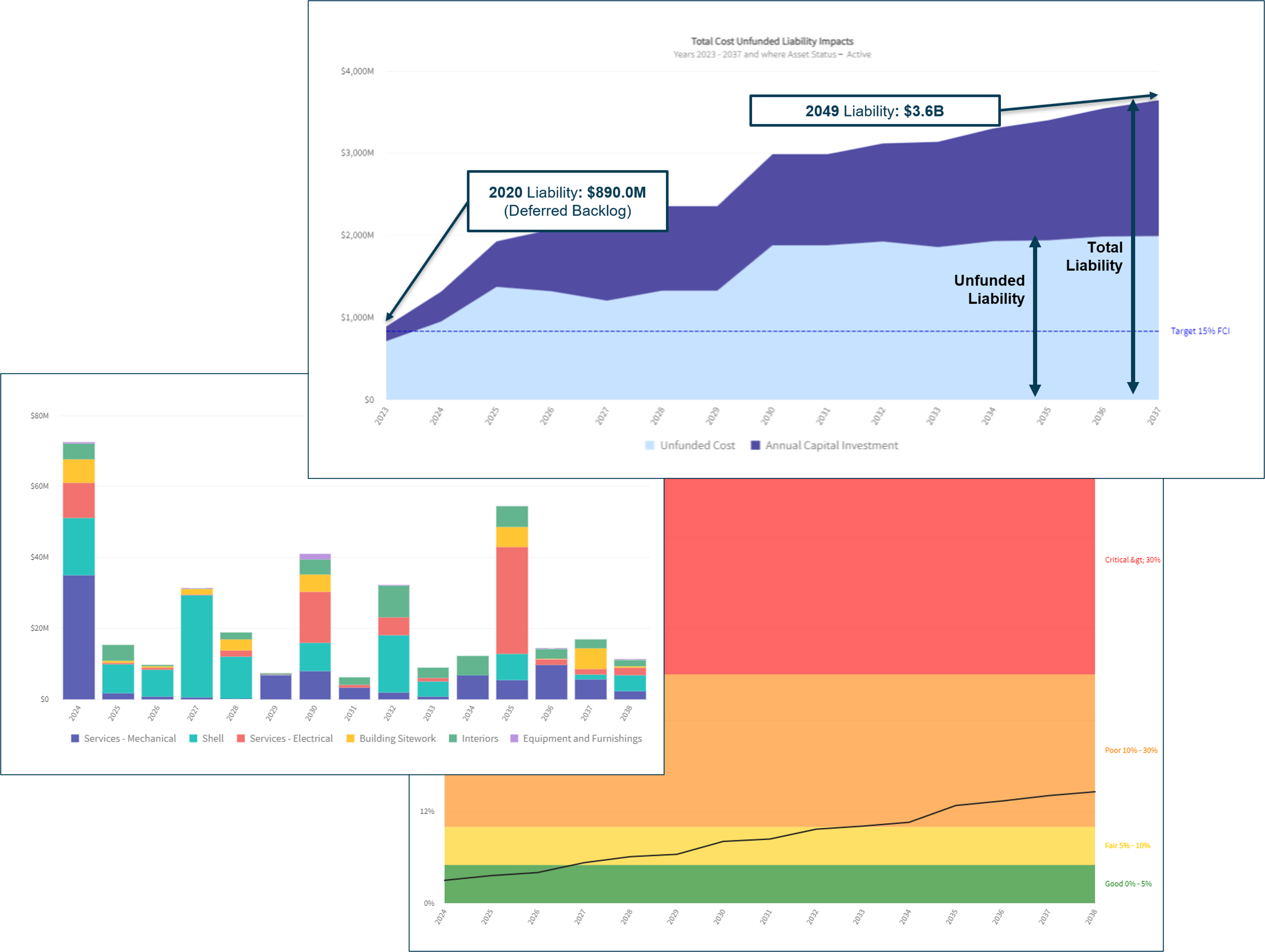
Many organizations have already spent significant time and resources collecting facility information. The problem isn’t lack of data, but that the data is often disorganized, inaccessible, or outdated. Capital planning software helps address this by pulling data from various silos and aligning it to a spatial reference.
As we build these systems for our customers’ facilities and campuses, the goal is to create a “living” planning environment. Remote tools are used to visualize asset registries, facility condition assessments (FCA), and prioritization logic to support tactical decisions. Instead of static reports, today’s facility managers gain an interactive, constantly evolving view of their environment.
Impacts Beyond Capital Planning
The operational benefits of remote visualization are equally important. Facility staff gain faster onboarding with reduced training time and fewer site visits. Maintenance technicians can identify which systems reside in which rooms and what access is needed to perform work. Emergency response teams can plan for entry points, hazards, and staging areas.
Remote visualization can also support insurance documentation, space utilization studies, and energy retrofit scoping. For leaders managing multiple sites or fielding requests while offsite, it becomes a practical tool to understand conditions, direct personnel, and improve daily efficiency.
A Necessary Shift
Modern facilities have become complex and geographically dispersed – not an ideal state for paper drawings and in-person briefings to remain the default. Remote access to updated spatial data is no longer a convenience but required for savvy capital planning and ongoing operations.
Remote visualization can help teams reduce cost, move faster, and make decisions with greater confidence. As infrastructure ages and staff are increasingly expected to do more with fewer resources, these tools will become central to efficient, defensible facility management.
This free resource provides a tangible roadmap for organizations looking to reduce their carbon footprint and achieve net zero emissions. The built environment is responsible for roughly 40% of energy-related carbon emissions. This resource offers a holistic approach to cutting consumption, costs, and carbon and practical solutions for facility owners and operators.


